Sea and Mountains of Katon-Karagay
A perfect 5-day group journey to the main treasures of East Kazakhstan.
We will visit the Bukhtarma Reservoir with its dramatic rocky shores covered in pine forests.
We will explore the mysterious Katon-Karagay, famous for its unique honey, wild herbs, pine nuts, and breathtaking landscapes.
During the trip, we will swim in one of the world’s largest reservoirs, travel along the historic Austrian Road, cross the Burkhat Pass, and admire the highest peak of Siberia and Altai - sacred Mount Muztau (Belukha), reflected in the mirror-like waters of Lake Yazovoye.
We depart weekly from Monday to Friday.


3-5 km per trip

on the route: 2,300 m

recreation centers

of Katon

3 to 14 people


guest house
or small hotel
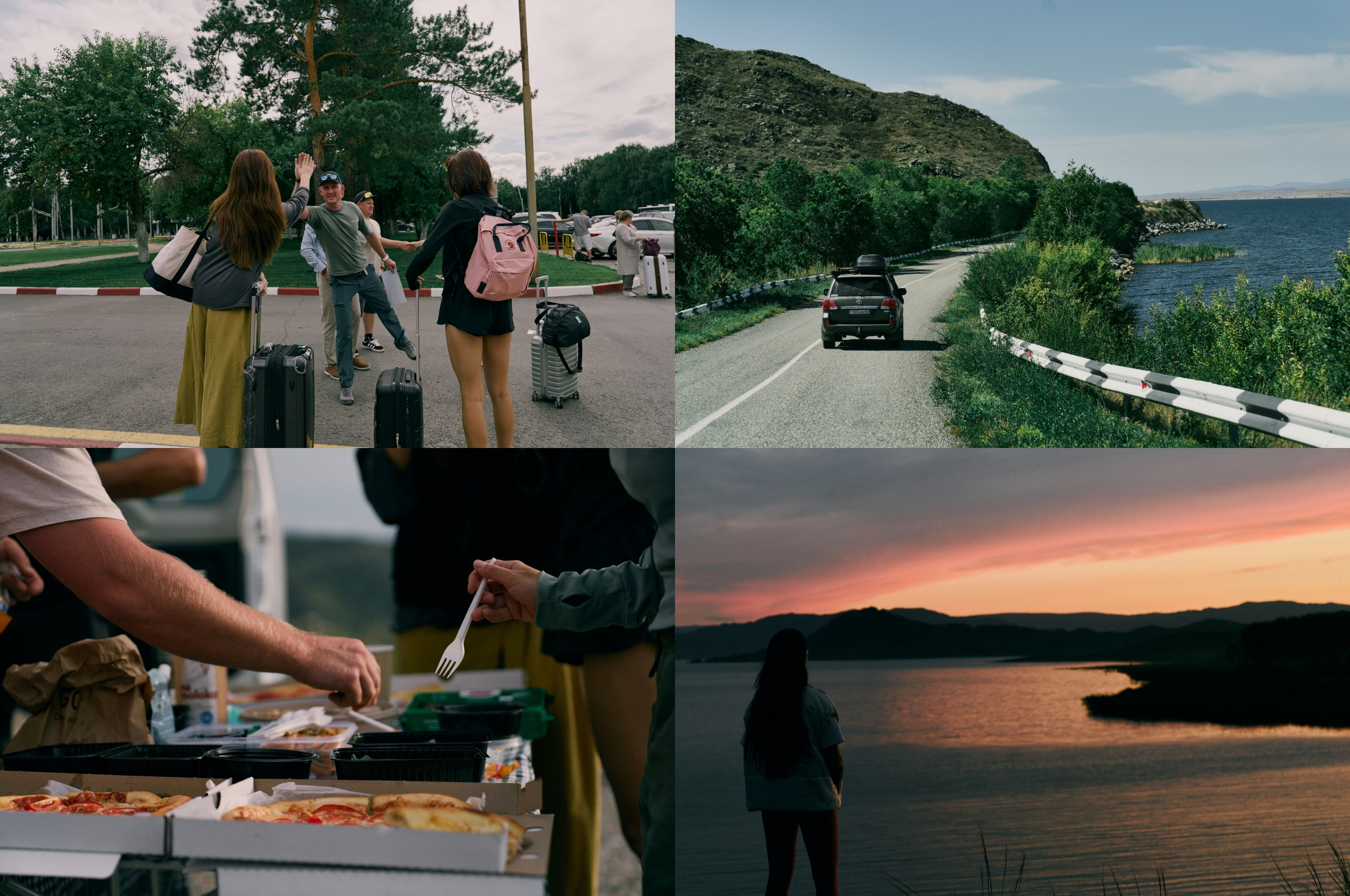
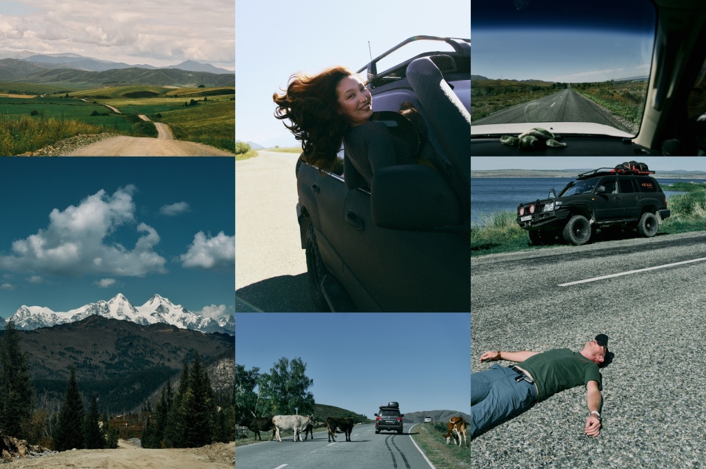
Arrival in Ust-Kamenogorsk. Meeting the group at the airport. Short briefing with the guide about the travel program. Seating in vehicles and departure towards Katon-Karagay.
After about 1.5–2 hours on the road, we will reach a beautiful bay offering a stunning panoramic view of vast sunflower fields set against the backdrop of the Bukhtarma Reservoir. Here we will arrange a picnic while watching the sun set into the endless water horizon.
The Bukhtarma Reservoir occupies a significant part of the Bukhtarma depression. It consists of two main sections: the river section - in the valley of the Irtysh River, the lake section - formed on the site of Lake Zaysan, where a vast open water area has developed. According to a number of sources, the Bukhtarma Reservoir is one of the largest artificial reservoirs in the world. Its area is approximately 5,490 km². In the valleys of the Bukhtarma and Narym rivers, as well as in the Monchekur depression, bays were formed ranging from 30 to 50 km in length and up to 10 km in width. The reservoir provides a deep-water navigation route and improves navigation conditions on the Irtysh River. The creation of the reservoir is associated with the construction of the Bukhtarma Hydroelectric Power Station. The filling of the reservoir began in 1960.
.png")
Afterward, we will make a short transfer to Altai Bay, where we will stay at one of the recreation bases on the shore of the Bukhtarma Reservoir. Accommodation, dinner, and rest.
.png")
*We have selected several comfortable recreation bases and will stay at one depending on availability. Double or triple rooms with private shower and toilet.
small hotel or guest house
guest house
Wake-up at 8:00 a.m.
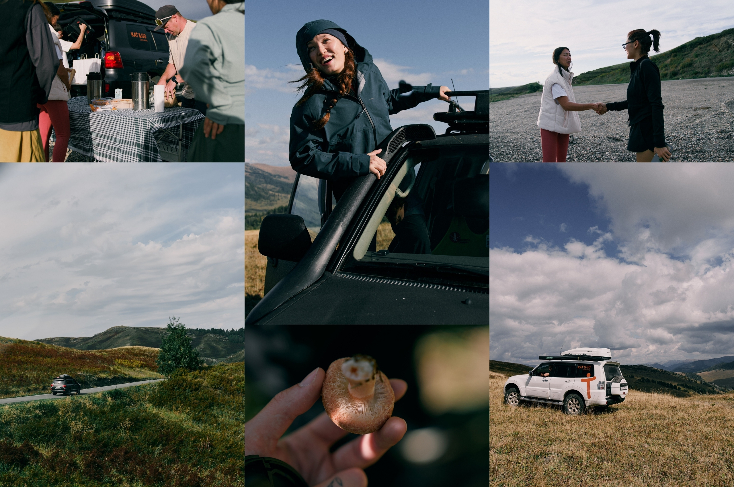
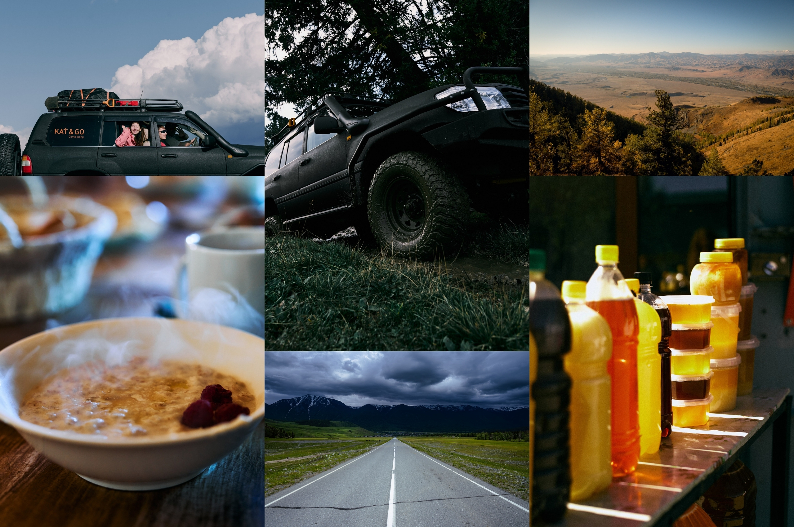
Breakfast and preparation. Departure no later than 12:00 p.m. The day begins with the “Road of Dreams,” often considered the most scenic road in East Kazakhstan Region. We will drive along the reservoir shoreline and, depending on weather and preference, stop at a wild beach for swimming and a picnic.
In the afternoon, the landscape will gradually change: mountains will grow taller outside the windows, and the reservoir will disappear in the rear-view mirror. We will arrive in Katon-Karagay. We will stroll through the local market where you can purchase honey, herbs, tinctures, and pantocrine. We will visit several semi-ruined historical sites dating back to the 18th century.
The settlement of Katon-Karagay was formed in the Soviet period by merging two localities - not Katon and Karagay, but the volost settlement of Katon-Karagay (founded in 1868) and the Cossack stanitsa Altayskaya (founded in 1871). The two settlements were located about two versts (approximately 2 km) from each other.
.jpg")
Here is how they were described by the well-known regional researcher, priest Boris Georgievich Gerasimov, in his article “A Trip to the Rakhmanov Mineral Springs”:
“The stanitsa Altayskaya lies in the valley of the left tributary of the Bukhtarma River and is completely immersed in the greenery of gardens. Irrigation channels run murmuring along the streets. A beautiful, dense alley, mainly of birch trees, gives the settlement a picturesque appearance. In stanitsa Altayskaya, the postal route from Ust-Kamenogorsk ends and is replaced further on by a local district road. The fair held from December 6 to 19 reportedly has a turnover of up to 250,000 rubles…
The Katon-Karagay settlement is located two versts from stanitsa Altayskaya. The settlement has a market, a customs office, a school, the chamber of a justice of the peace, and a small hut on chicken legs with the sign ‘Altai Detention House.’ The rural chief of Ust-Kamenogorsk district also lives here.”
By evening we arrive at our accommodation. Dinner and rest.

*Accommodation in a guest house or small hotel, depending on availability. Double or triple rooms with all standard amenities: private shower and toilet.

are off-road
guest house

guest house
Wake-up at 8:00 a.m.
Breakfast and departure by 10:00 a.m. Leaving Katon-Karagay, we head toward the so-called “Austrian Road,” climbing to a viewpoint near Burkhat Pass.
This unofficial name comes from a little-known historical fact. Prisoners of war from the former Austro-Hungarian Empire were brought to the outskirts of the Russian Empire, near the borders with China, during the years of the First World War (1914–1920). Under inhuman conditions, in just two years (from 1914 to 1916), at an altitude of 2,000 meters above sea level, they manually built a mountain road.
The road was constructed to connect Altai with the Irtysh region and had a purely strategic purpose for guarding the borders of the Russian Empire, as it reduced the distance from Katon to Markakol from 500 km to 90 km. Therefore, the road can also be considered a monument to heroic human labor. It was built by only 300 people (!). How many of them died during construction, how many returned home, or how many remained in Kazakhstan - no one knows today…
.jpg")
At the viewpoint, we will admire breathtaking views of the Bukhtarma River valley and, weather permitting, see Mount Muztau (Belukha), the region’s main landmark.
.jpg")
We will have a picnic here. Depending on mood and weather, we may walk to a nearby cedar forest, collect cones, and perhaps enjoy fresh blueberries. In the evening, we descend and head to the guest house. Dinner and rest.

*Accommodation in one of the guest houses in the villages of Uryl or Berel, depending on availability. Double or triple rooms with standard shower and toilet facilities.
.png")
are off-road
guest house
guest house
Wake-up at 8:00 a.m.
Breakfast and departure by 10:00 a.m.
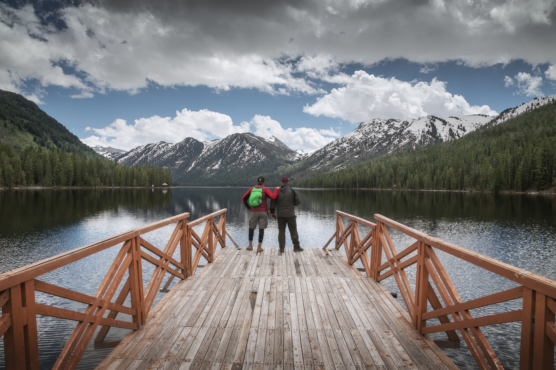
Depending on weather and road conditions, we will visit either the Rakhmanov Springs or Lake Yazovoye. Each place is unique and interesting in its own way.
Lake Rakhmanovskoye is located in a narrow mountain valley surrounded by forested slopes at an altitude of about 1,800 meters above sea level. The lake is approximately 2.5 km long and about 600 meters wide. According to various sources, its maximum depth reaches 30 meters.
In summer, the water temperature usually does not exceed 15°C. Local residents say that the lake was named after a hunter named Rakhman, who lived and hunted in these areas long before they became popular. A legend about the discovery of thermal springs on the lake’s shore is also associated with him.

Lake Yazovoye is very popular among tourists aiming to reach the foot of Belukha or climb its summit. It is located along the most popular trail in the area, leading to the Kok-Kol base camp, where many natural attractions are concentrated.

The lake is about 3 km long and 500 meters wide. Its maximum depth reaches 10 meters. It lies at an altitude of approximately 1,655 meters above sea level. The water temperature is relatively high for a mountain lake due to its dark color and silty bottom. It is said to be the only body of water in Southern Altai where ide fish are found in abundance - and fishing for them is permitted here.
In good weather, the shores of the lake offer a stunning view of the two-peaked Belukha massif.

Picnic during the day. We will return to the guest house in the evening.

depending on the situation
Early wake-up depending on flight schedule. Breakfast and departure to Ust-Kamenogorsk. We will stop for lunch at a cafe or organize a picnic along the way. Upon arrival in the city, transfer to the airport and departure home.
! Please note: Since Katon-Karagay is located in a mountainous area with specific weather conditions, the organizer reserves the right to adjust the itinerary solely to ensure the safety and comfort of the group.


