The Great Altai Adventure
A comfortable, easy 4x4 jeep tour to the most famous highlights of Katon-Karagay, as well as Lakes Markakol and Zaysan. On this trip, we’ll discover the region’s unique culture, historical landmarks, and natural attractions — and most importantly, we’ll see Belukha, the highest peak of the Altai and Siberia. We’ll also visit the largest lake in the Kazakh Altai and the ancient Lake Zaysan. This journey is a great fit for both experienced travelers and first-time adventurers.


berries, and tasting
local delicacies


fishing


overnight


at the hotel
Departure from Ust-Kamenogorsk. Transfer to Zyryanovsk (Altai) in the very heart of Kazakhstan Altai
Zyryanovsk was founded in 1791 to be a mine camp of the Altai mountain region. It happened after Gerasim Zyryanov found a polymetallic ore deposit here. The village was named after his name. It started growing into the city only in 1833 and continued up to 1991. In 1941-1945 (the Great Patriotic War) the State Musical Drama Theatre of Poltava was evacuated to Zyryanovsk.
The city's economy has always been based on mining. In 1791, ore mining began at the Zyryanovsky mine. In 1892, the first industrial hydroelectric power station in Russia was built in Zyryanovsk on the Berezovka River. Despite the fact that the city is industrial, the cultural life of the townspeople did not go unnoticed. There are quite a few community centres which maintain different creative dimensions.
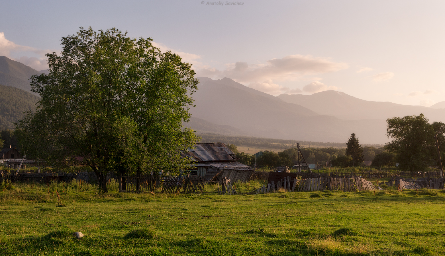
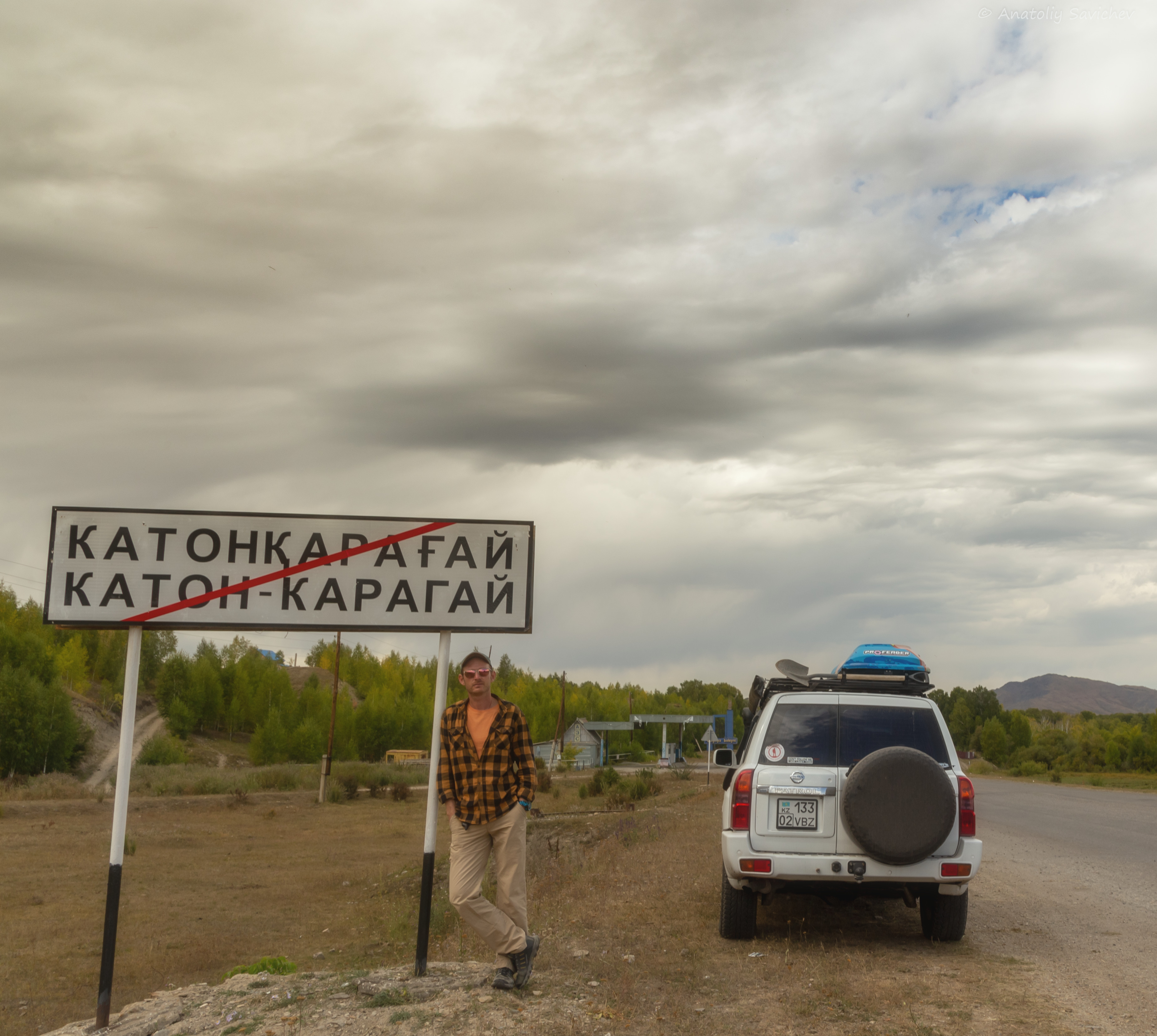
After a short tour around the town the next is a transfer to Katon-Karagay. We will have a picnic on the way. If you’d like to take a picture we can stop any time - the road is picturesque.

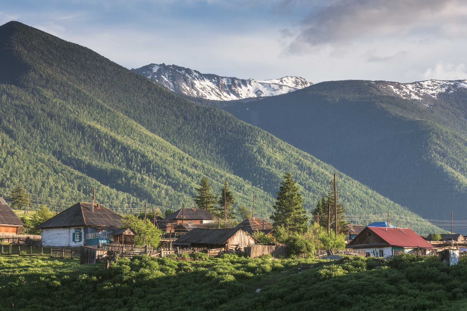
Katon-Karagay village was formed from two villages, but not Katon and Karagay. It merged from Katon-Karagay settlement (founded in 1868) and Cossack Altaiskaya stanitsa (founded in 1871). The two villages were only 2 versts from each other.
This is how a famous researcher, priest, Boris Georgiyevich Gerassimov refers to those places in his article “A Trip to Rakmanovskiye Mineralniye Klyuchi”
“Stanitsa Altaiskaya lays in the valley of the left-bank tributary of the Bukhtarma river. It is all covered in the green of gardens. Irrigation canals purl along the streets. Amazing thick birch alley makes the village very attractive. The postal road from Ust-Kamenogorsk ends in the village of Altaiskaya and is replaced further by zemskiy tract. The area where the village of Altaiskaya is located had previously belonged to China, but after the border was demarcated, it de facto became the possession of the Russian government. Altaiskaya has: a church, a beautiful school building, a post office (Katon-Karagay), here is the seat of the Altai forester, medical personnel and veterinary supervision. The fair, which exists from December 6 to 19, is rumored to have a turnover of up to 250 thousand rubles ... The Katon-Karagai settlement is located two versts from the Altayskaya village. In the village there is a market place, a customs office, a school, a magistrate's cell, a hut on chicken legs with a signboard "Altai Arrest House". The peasant chief of the Ust-Kamenogorsk district also lives here."

Currently, these two settlements form a single whole. However, unlike the beginning of the 20th century, the beginning of the 21st century can be characterized as a period of significant decline in Katon-Karagai. Before, there was a large number of houses, but now there are only grassy hillocks, many buildings are in ruins and make a painful impression. The Orthodox church is in the ruins too, you can see it once you enter the village...
Upon arrival there is dinner and rest at the local hotel.


at the hotel
at the hotel
overnight
Today we wake up early, at about 7 am. After breakfast we go on a small mountain adventure to the Sarymsakty gorge. We will have a 5 km drive on the mountain road to have a short walk towards the waterfall.

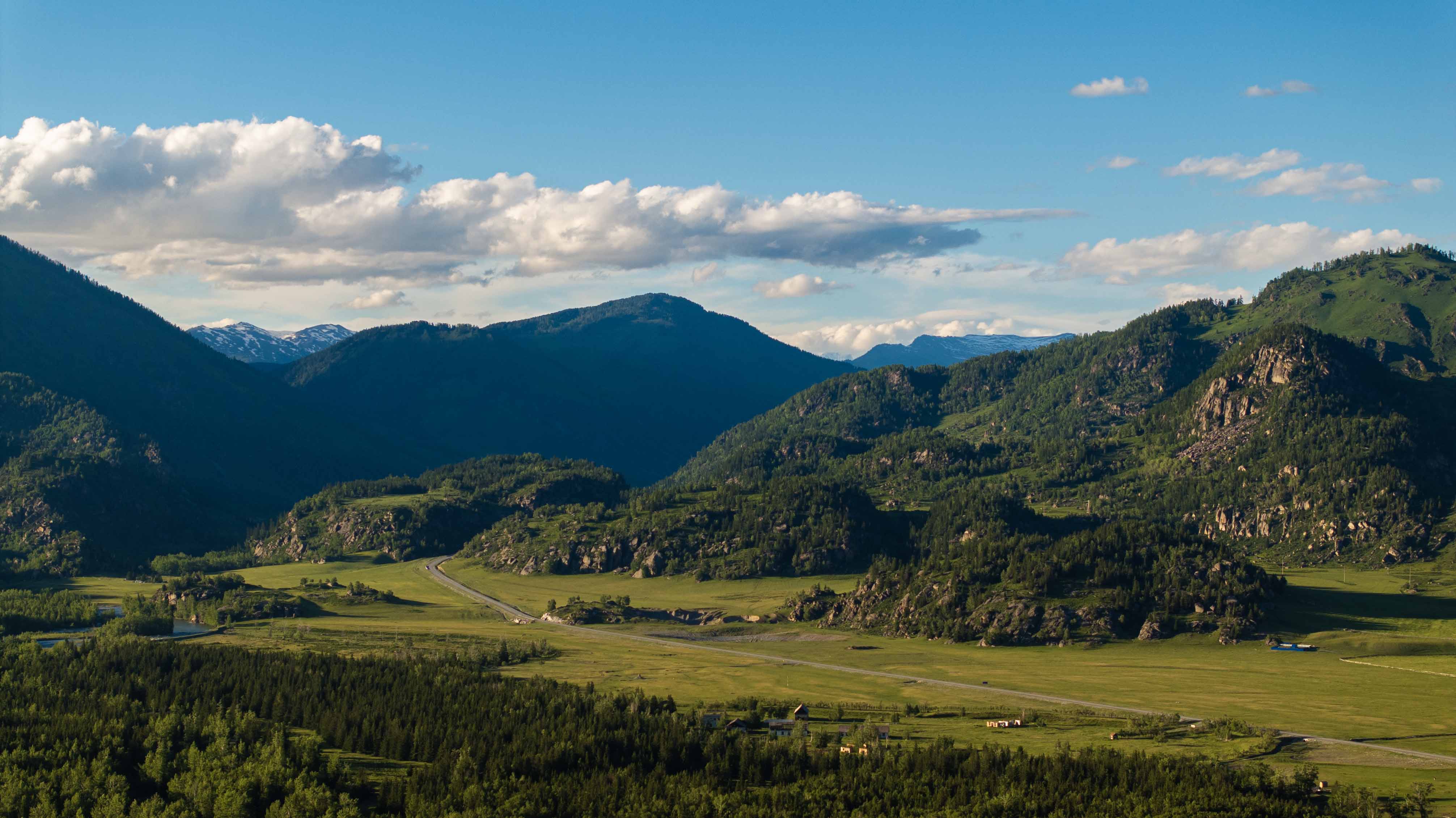
Sarymsakty is a mountain ridge in southern Altay. The length is about 60 km, upper point - Berkutaul (3373 masl). In the south, the ridge is bounded by the Kurchum River and the Kurchum mountain range, in the north it is bounded by the Bukhtarma River. On the eastern side it borders with the Tarbagatai ridge, which offers a beautiful view from the Kyzylkum pass. It is noteworthy that the ridge has a completely different structure on both sides. From the north, these are steep, formidable rocks and glaciers, large enough for this latitude. From the south, the ridge is more gentle and very rich in vegetation: from cedar forests to alpine meadows and high-mountain tundra. The Sarymsakty valley is popular because it is relatively easily available. It is located next to the Katon-Karagai village and has a lot of cascading waterfalls and alpine lakes (more than 100), most of which do not even have names.

We will have a short rest at the waterfall with delicious rolls and hot herbal tea. Those daring can try and swim in a small lake near the waterfall. Then we need to return to the car and go down to the village.
We return to the hotel, dinner and rest.
at the hotel

guesthouse

ourselves

hunting lodge
Breakfast at the hotel, packing and departure to Yazovoye lake. Today we are driving along the right bank of the Bukhtarma river. We’ll enjoy the view, take pictures, walk, rest and explore. The first stop is in Vera Pavlovna's guest house.

This is a unique place in the Kazakh part of Altai, and everyone who visits it will find something new for themselves, which they could not have thought of before. The peasant farm of Vera Pavlovna Klimova was created by her father Pavel Fedorovich. Calling it simply "Klimov", after his last name. Despite the fact that Vera Pavlovna was born in a family of beekeepers, she began to actively engage in bee breeding only in 2001, when her father passed away, and she had to take over the management of the farm. However, Vera Pavlovna not only successfully continued to engage in beekeeping, but also went further, deciding to organize an unusual health-improving guest house in her apiary, using bees for this. In short, the essence of the process lies in the fact that it is necessary to sleep in bee hives, in a room specially equipped for this. So far, the apiary has two small houses with benches on the hives. Scientifically, this method of recovery is called bioresonance therapy. It is quite popular in Russia.
Those innovations are built on a balanced relationship between a human being and nature. Her apiary attracts those interested in the mix of local cultures and specific Altai beliefs. In addition, there’s also alternative medicine which goes back to the knowledge of beekeepers, herbalists and maral breeders who lived centuries ago.
After a delicious lunch, philosophical conversations and a visit to the apiary, we go further to the Berel archaeological complex.

Today, the Berel burial ground has more than 100 burial and memorial structures of the era of early nomads. It is based on several parallel chains of mounds, elongated in a general north-south direction, with a slight deviation.
The first excavations were carried out here back in 1865 by the famous archaeologist V.V. Radlov. According to the results of excavations, it became clear that the burial ground belongs to the royal nobility. The fact is that in the last decades of the XX century in the adjacent region - in the Russian Altai, new monuments were discovered that are directly related to the "phenomenon of Pazyryk mummies". This refers to the discovery of the famous Ukok princess, in the permafrost burial ground on the Ukok plateau, located about 100 km from the Berel burial ground. The Pazyryk culture is undoubtedly multiethnic, consisted of many population groups that differed in the ethnographic appearance, and lived throughout the entire Altai mountain system. Thus, the Berel group of monuments, which have some ethnographic differences as a sign of respect for the Altai monuments, should be considered in these studies as a local version of the Pazyryk culture.
The Berel necropolis has been known to the general public since 1998 due to unique findings from one of its largest mounds.
In 1997 - 1999, an international expedition of archaeologists from the Kazakh Institute of Archeology worked in Berel. It consisted of scientists from a number of research institutes, universities of the republic, the East Kazakhstan Museum of Local Lore, as well as the archaeological mission of France in Central Asia and the Italian research center Ligabue. This group of researchers discovered a royal burial. The tsar and tsarina and thirteen red horses in full dress rested in the mound for about two millennia! The studied mound is a special structure erected for the burial of a person who occupied the highest position in the social ladder of the nomadic Scythian-Saka tribes’ society in the Altai subregion. The design of the mound made it possible to preserve the mass of organic material.
These discoveries, in fact, laid the foundation for the development of the problems of ethnogenesis and ethnic history of the ancient, medieval and modern nations of the Central Asian region.
Then we will visit the museum with artifacts from the burial. The guide in the museum will tell a lot of interesting facts. While we are exploring the ancient culture of Altai, Vera Pavlovna has already prepared a mind-blowing lunch for us to go. In the afternoon we’ll visit the burial site itself. After we immerse ourselves in the culture of ancient Altaians we will move to Yazovoye lake.

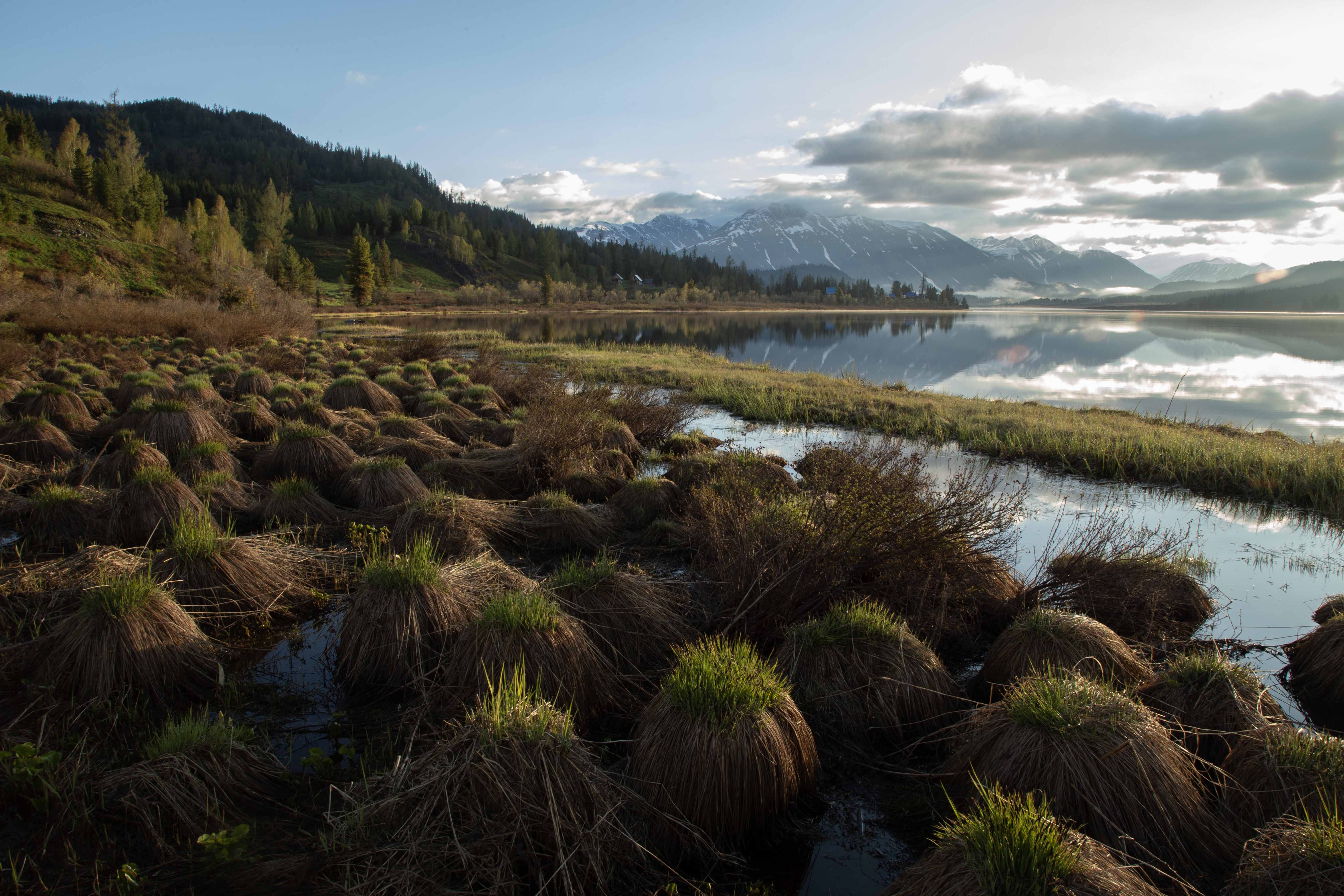
The lake is very popular among tourists seeking to get to the foot of Belukha, or to the very top. After all, it is located, perhaps, at the most popular trail in the area, leading to the lower camp of Kok-Kol, which has lots of attractions. The main feature of the lake is a tourist base founded in the distant Soviet Union. To this day, the base operates and receives many tourist groups. There are those who are already returning from the mountains and those who are just going to Belukha. Noisy feasts and songs with a guitar are very common, as well as modest conversations about the search for Shambhala after visiting a real Russian banya.
The lake is about 3 km long, about 500 meters wide, and up to 10 meters deep. An interesting fact is that the water is quite warm for a mountain lake. It is located at an altitude of about 1655 meters above sea level. All thanks to the dark color of the water, and the muddy bottom. It is said that this is the only body of water in the southern Altai, where ide is found in abundance. Ide fishing, by the way, is allowed here.
In good weather you can get a good view of the two-headed mountain - Belukha - from the shores of the lake. Sometimes Belukha is reflected in the water surface of the lake.
The Yazevaya river flows out from the lake. About 5 kilometers downstream, there are several cascading waterfalls. They are called Yazevy waterfall.
Upon arrival - accommodation at an old tourist base. You now have a choice of going fishing or just admiring the top of Belukha in the reflection of the lake.
***Keep in mind that it’s possible there will be no room on the tourist base for us to stay. In this case we’ll set up tents.


cook ourselves
guest house
guest house
We’ll wake up early, have a snack and have a 2 kilometer walk around the lake. This will allow us to watch the enchanting sunrise panorama of Belukha. After: we return to the camp site or to our camp - a full breakfast, packing and transfer in the direction of the Uryl village. The first thing to see today is Yazevy waterfall.

Picturesque rocky shores covered with soft moss and lingonberry will not leave you indifferent. Spruce is a queen here. The height of trees sometimes reaches 20-25 meters, the average age is 90-100 years. Those daring to go down the trail along the coast to the lower rapids, can take wonderful photos of the entire cascade from natural rock observation platforms. In the rushing stream of the river, just below the waterfall, amateur anglers can catch a silver grayling.

After the walk around the waterfall we’ll drive to the Uryl village.
There is a funny legend among tourists about how the village was named. It is connected to the history of the village. Many people think that Uryl is the easternmost settlement in the Kazakh Altai. But this is not entirely true, there are several more villages that are located closer to the border. Uryl originally belonged not to Kazakhs (as it does now) and not to Old Believers, but to Cossacks - like an outpost between the brick masons' volost and the Chinese border. It was founded in 1872. So the tourists composed a story about how some Urunghai attacked the outpost from the territory of China, and the Cossacks didn’t hesitate to fight them away (in Russian old slang – ‘uryl’) - that is why they called the village ‘Uryl’. But that’s not what happened. It turns out that the outpost and the aul of the same name bear the name " ‘Or Yel’, that means “an aul located high in the mountains”. Almost an Eagle (Oryol in Russian)! In the army, by border guards, this is all distorted to the obscure and derogatory Uryl. Of course, it is also due to renaming in the Soviet period. Now, Uryl has returned its ancient and true name - Orel (Or spruce), which means - a village on a hill.

We’ll visit a bakery upon arrival. Having bought some fresh bread and go to a guest house for an overnight stay.
Yasnaya polyana. It is almost impossible to find words to describe this place. It has everything to be fully absorbed in Altaian culture, escape the city rush, revitalize your body and mind with the energy of the breath-taking beauty of the nature. What is it, then? Yasnaya polyana? Wooden house (log house), built and decorated by the owners' own hands. Love and care of guests is put into every element of the interior. A real rustic wood-burning stove, a turntable with a huge collection of vinyl records. And a huge number of interior items made by the hands of the owner of the house. Cozy ails, traditional hexagonal houses of the ancient Altaians, are also built and decorated with love and awe, which are felt in every detail. An excellent bathhouse, a hot steam room with a bath besom, a comfortable relaxation room await you. The bathhouse stands on the river bank, and you can swim a bit there after a hot besom. The country-style food in Yasnaya Polyana is very simple, but healthy. The cuisine is close to the Old Believers' one. The menu includes local homemade milk, koumiss, sour cream, butter, meat, berries and mushrooms. Home-cooked meals made with love. On the table there will be porridge, cheese cakes, pancakes, pies and cabbage soup. And, of course, sweet-scented herbal tea from a samovar.

When we arrive at Polyana, the first thing to do is banya, then dinner and rest.

guest house
guest house
guest house
After breakfast, we go to the panoramic point - the Burkhat pass, located on the old Austrian road.

In fact, it is rather difficult to understand what exactly makes this road unique. Starting in the village of Chingistay, it goes almost strictly to the south through the Burkhat pass, (2100 meters above sea level), from which a view of the Katunsky ridge and the Bukhtarma river valley opens. Further through the Alatay pass and the unique Markakol lake to the Mramorniy pass, from which a grandiose view of the Kyzyl Kum sand dunes, located on the Chinese side, opens. And then to the Terekty village, which borders with China. A lot of historical events in the region are associated with this road. Their studying has started only after a hundred years after its construction. It is also unique in its location, surrounding nature and sights that it passes by. Sometimes it is not at all clear which is more interesting: the road itself or the objects located on it...
The road got its name (which is not official) because of a little-known historical fact. Prisoners of war from the former Austro-Hungarian Empire, were brought to the outskirts of the Russian Empire, to the borders with China, during the First World War, in 1914-1920s. And there, in inhuman conditions, in just two years (from 1914 to 1916), at an altitude of 2000 meters above sea level, a mountain road was manually built. It was built in order to connect Altai with the Irtysh region. This road was of an exclusively strategic nature to protect the borders of the Russian Empire. After all, it shortened the path from Katon to Markakol from 500 to 90 km. Without a doubt, it can also be regarded as a monument to human heroic labor. After all, only 300 people(!) built it. No one knows how many of them died at the construction site, and how many returned to their homeland or remained in Kazakhstan today...

At the Burkhat pass there is a wonderful observation deck and a gazebo for rest. Here we will stop, admire the valley of the Bukhtarma river. If we are lucky we will taste raspberries and strawberries. After a little rest, we go further to the valley of the Kara-Koba river, where we will stop for lunch. Then, after the Alatay pass, we will continue our journey to the village of Urunhaika.

An ordinary-looking Altai village, with blackened log cabins in the lowlands and on the hills, bathhouses, woodpiles, potato gardens. It has an unusual name - Urunhaika, along the river of the same name, which flows into the Markakol lake. According to one of the many versions, the name comes from the Kalmyk tribe Urumkhai, or Urapkai, that once upon a time was bringing their herds to Markakol for summer pastures.
There is almost no written evidence of this tribe. In the old pre-revolutionary magazine there are several lines about the Urun-Khaits. The author of the article wrote: “Thanks to their amazing mines, they make their way there among the mountains, where no one else can get through”. The writer V. Pravdukhin, traveling through the Southern Altai, found old people who still remembered the Urun-Khaits. They were all, according to stories, excellent hunters, and they shot from antediluvian flintlock rifles weighing up to ten kilograms. Also, the memory of the Uruphais or Urunhai, as they were also called, remained in folk legends. Lake Markakol is the coldest point in the East Kazakhstan region. Residents of the village of Urunhaika check the weather by the Samovarka mountain - if the top of the mountain is foggy, it will rain.

Upon arrival to the village, we check into a guest house and have dinner. After dinner – visit to the bathhouse in the middle of the forest. Rest.
guest house
guest house
guest house
This is a day of rest in the village of Urunkhaika on the shore of Lake Markakol. We have breakfast and go for a walk through a rather authentic village. We reach a small area on the shore of the lake and have a picnic lunch. *If the weather permits, we will arrange a boat trip on the lake.

The lake is located at an altitude of 1450 m above sea level, between several mountain ranges: Azu-Tau in the south, Sorvenok in the east and Kurchumsky in the north. So far this is the largest body of water in Altai. The length of the lake is 38 km, the width is 15 to 20 km, and the depth reaches 30 meters. The origin of Lake Markakol is associated with one of the glacial phases of the Alpine tectonic cycle, when, as a result of uplifts and faults, a peculiar system of modern ridges and intermontane depressions was formed. Then it was subjected to the effect of glaciation, the traces of which are well clearly visible at the watershed parts of the Kurchum ridge. About 30 large rivers flow into Lake Markakol, and only one flows out - the Kalzhyr River. The lake is surrounded by sparse mountain taiga, with larch, spruce, cedar, fir, and birch. Poplar, willow, birch, a lot of bushes (lots of them are berry bushes) grow directly along the shores of the lake. The uniqueness of the nature led to the establishment of the Markakol reserve at this area in 1976. The mammalian fauna includes 55 species, including: bear, lynx, red deer, roe deer, marmot, Siberian ibex, etc. Particularly valuable are the otter, the snow leopard (several of which live in the alpine zone), the wolverine, and the sable. From the middle of the 18th century, when the Dzungars left, local Kazakhs drove cattle to summer pastures in the mountains surrounding the lake. Perhaps, it was them who gave the name to the lake, as the word "mark" means "young lamb". Since that time, caravans of Russian peasants went fishing every summer from Bukhtarma and Irtysh to the lake. In 1881, Markakol, which belonged to China before, was given to the Russian Empire under the Treaty of Tarbagatai. At the very beginning of the 20th century, first permanent resident who came from the Tomsk province, Frol Mikhailovich Minaev, built a hut at the lake shore and settled there. This was the beginning of the first village on the banks of the Markakol lake, with a funky name - Urunhaika. It still exists.

In the evening we return to the guest house, have dinner and go to the bathhouse.

guest house
restaurant
We’ll wake up early. Preparation and breakfast. We're going to have quite a busy day today. We will drive through the “Mramorniy” Pass, make a stop at the observation deck. We will admire the sand dunes of Kyzylkum for a while, then we will drive 200 meters from the border with China, and even visit roaming. After passing the border village of Terekty, the mountainous part of our trip will end, and we will find ourselves in a semi-desert zone, where the first attraction will be the bizarre Kiin-Kerish tract.

Not far from Lake Zaisan, in the semi-desert zone of the Ashylykul valley, there is a small depression. There you can find red, white, yellow clay remnants of different shapes. This place is quite ancient, 15 to 30 million years, according to scientists. Lots of imprints of ancient plants and the remains of vertebrates from the Mesozoic period were found here. Today, it is one of the most important paleontological deposits in Europe and Asia. There are many mysterious legends about Kiin-Kerish. It is also called the City of Spirits, Flaming Cliffs. Many are sure that there is a special energy in the canyon, and this is probably why in ancient times sacrifice rituals took place here. Two unique species of plants grow here as well as several species of animals and birds that are listed in the Red Book.

We will have a walk around the valley and take interesting pictures. If you get lucky you find an artifact or remains of an ancient animal. After the walk, we will have a picnic in one of the canyon gorges, where you can hide from the wind. After lunch we will continue our journey through the desert to the next, but as interesting point - Cape Shekelmes.

Just 32 km from the Kiin-Kerish valley, on the shores of Lake Zaisan, there is the "Castle of the Mountain Spirits" - Shekelmes Canyon. Geographers claim that a meteorite struck this place, having moved and exposed a rock that is 100 million years old. Fragments of a meteorite and ancient rock have created another East Kazakhstan miracle. Actually, the same meteorite, tearing apart the ancient rocks, led to the formation of two capes - Barkhut and Baklaniy. Shekelmes is located right between them. It is clay and sandy mountains, weathered and washed by rains, drops of which have frozen in various forms. In the sections of the Shekelmes canyon, you can, if you're lucky, find the bones of fossil crocodiles, salamanders, dinosaur egg shells, remains of ancient plants and much more. On the shore, many tourists collect fragments of transparent gypsum, polished by the waves of the lake, as a keepsake. These places are inhabited by families of pelicans and cormorants, who love to bask in the sun on the sandy shore. Sunset is magical here. The colors of the setting sun penetrate the lake and illuminate the desert landscape with bright and saturated colors - orange, red, yellow. At night, the skies are deep and dark, the stars are scattered like pearls. The nights are filled with the intense tart aroma of desert herbs, warm breeze and the sound of waves. All this impresses visitors and leaves an unforgettable impression.

At the end of the excursion we will have a picnic lunch, and then a long drive to the city of Ust-Kamenogorsk. Upon arrival, final dinner at the restaurant and accommodation at the hotel.
* On day 7 the route may be adjusted due to weather and road conditions.


